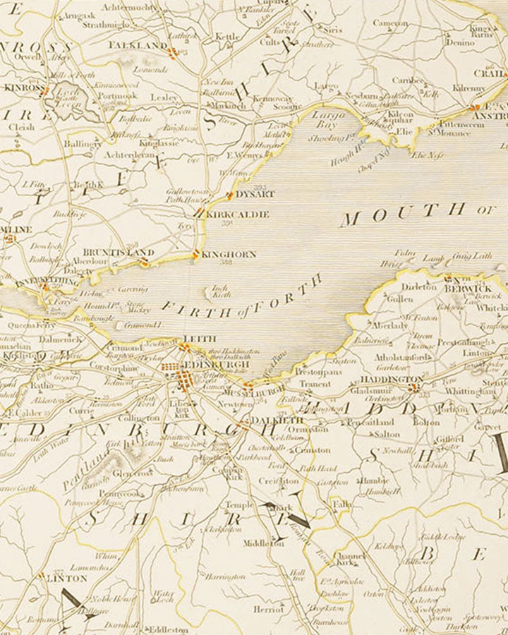
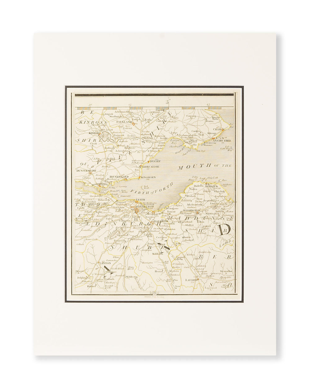
Authentic Road Map of the Firth of Forth by John Cary, 1794
Authentic Road Map of the Firth of Forth by John Cary, 1794

- Worldwide Shipping Available
- In stock for immediate dispatch
- Specialist Packaging
- Secure payments
This impressive map dates from 1794 and shows the Firth of Forth and Edinburgh as it was thought to be in the late 18th century. The map makes the perfect gift for the whisky lover who has everything.
Although not shown on the map, distilleries in this area of Scotland are Port of Leith, Holyrood, North British, Glenkinchie, and Kingsbarns.
All maps have been professionally mounted in acid-free mounts ready for framing.
Dimensions
Plate: 25.8cm x 21.4cm
Outer mount: 40.5cm x 30.5cm
The History of the Map
This map hails from a first edition of New Maps of England and Wales with part of Scotland (1794) by famed cartographer, John Cary. The map shows Edinburgh, and the Firth of Forth, as well as parts of Fifeshire.
John Cary, Cartographer (1755-1835)
Cary was internationally renowned for his cartography and undertook some impressive commissions during his life. He was apprenticed in London, and set up his own business on The Strand in 1783 as a map seller and engraver. His work included town maps, road maps, globes, and geological maps.
Before long, Cary had made a great name for himself and was soon tasked with completing some important commissions such as a survey of England’s roads in 1794, and the creation of Ordnance Survey maps.
New Maps of England and Wales with part of Scotland was published in 1794 and was the first atlas to refer to the Greenwich Meridian.
Bottler:
Age:
Vintage:
Bottled:
ABV:
Volume:


